✨ New Arrivals Just Dropped!Explore
$2.98
Original: $9.95
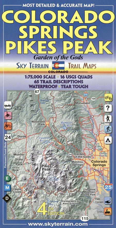
-70%Colorado Springs, Pikes Peak - 4th Edition—
$9.95
$2.98The Story
Sky Terrain Trail Maps Colorado Springs, Pikes Peak - 4th Edition is scaled at 1:75,000 and covers hundreds of thousands of acres in the Pike National Forest, Mueller State Park, Garden of the Gods, North Slope Area, South Slope, Rampart Range, Cheyenne Canyons, Cripple Creek, Air Force Academy, Fox Run, and more.
Specs
- Waterproof & tear tough
- Symbolic trail ratings for easy, moderate and difficult levels
- 65 trail descriptions highlight key features and "must sees"
- Trail, camping, hydrology, & geology index for quick reference
- Contours in easily counted intervals of 100 feet
- UTM & Latitude, Longitude coordinates for use with GPS
- Large scale detail maps of Garden of the Gods & Florissant Fossil Beds
- Advanced topographic shading and elevation tints reveal the stunning region in a never before seen light
- 3D view to the west w/ Pikes Peak profile
- Sheet size = 24 x 32 inches
- Folds to 4 x 8 inches
- Covers 16 USGS 24K Quad maps
Description
Sky Terrain Trail Maps Colorado Springs, Pikes Peak - 4th Edition is scaled at 1:75,000 and covers hundreds of thousands of acres in the Pike National Forest, Mueller State Park, Garden of the Gods, North Slope Area, South Slope, Rampart Range, Cheyenne Canyons, Cripple Creek, Air Force Academy, Fox Run, and more.
Specs
- Waterproof & tear tough
- Symbolic trail ratings for easy, moderate and difficult levels
- 65 trail descriptions highlight key features and "must sees"
- Trail, camping, hydrology, & geology index for quick reference
- Contours in easily counted intervals of 100 feet
- UTM & Latitude, Longitude coordinates for use with GPS
- Large scale detail maps of Garden of the Gods & Florissant Fossil Beds
- Advanced topographic shading and elevation tints reveal the stunning region in a never before seen light
- 3D view to the west w/ Pikes Peak profile
- Sheet size = 24 x 32 inches
- Folds to 4 x 8 inches
- Covers 16 USGS 24K Quad maps